Geophysics and agriculture: an electrical meeting

ERT in pototo field

| 2nd Agrogeophysics seminar |

After the success of the first edition ‘Geophysics & Agriculture: the perfect match?’ in 2020, we are pleased to give you all a new opportunity to exchange knowledge, good practices, and passion on current trending topics in agrogeophysics.

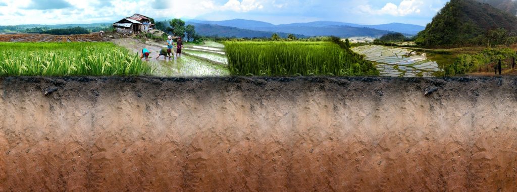
When applied to agriculture, geophysics targets physical quantities (resistivity, permittivity,elastic moduli …) that indirectly relate to soil and plant properties or hydrological variables. By consequence, Agrogeophysics is a discipline looking for indices to understand the complex interplay between the soil, the plant(s), and the atmosphere.

In the last years, particular attention has been devoted to the development of small-scale studies conducted on a single plant with the aim to translate geophysical observations to state variables governing the soil-plant interactions. On the other hand, we observed a momentum for larger-scale Geophysics using soil proximal to remote sensing in order to map and support agricultural decisions. Yet, although mainly focused on water management issues, agrogeophysics is not limited to and emerging frontiers topics show the potential of geophysical methods to highlight soil processes like carbon and nitrogen cycling.

You can submit any research related to agrogeophysics. We particularly welcome engagement of early-career scientists who are interested to work across groups, scales, and disciplines.

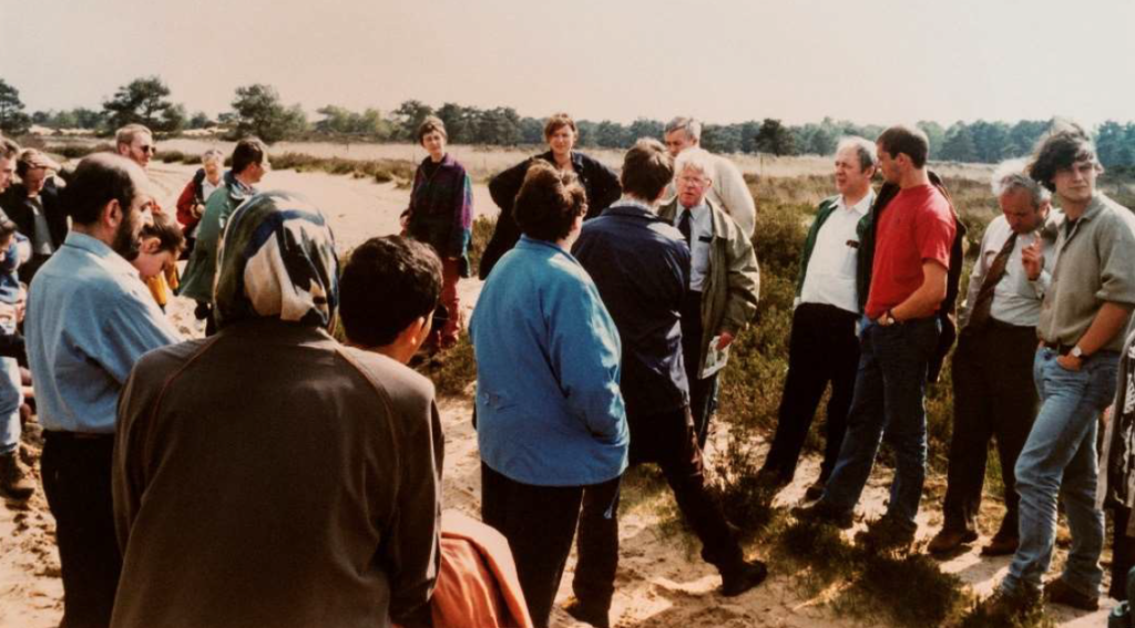
In an hackathon session we will work with those interested in some of the new initiatives in data management, codes integration, and standards in agrogeophysics and will encourage the gathering of pedophysical data.

Key dates and registration

  • Registration
    • deadline: February 25th, 2022
    • fees: 20€ for Phds, 10€ for master students, 40€ for all other cases
  • 🛬 Arrival + conference dinner: Thursday evening March 10th, 2022
  • 📅 Seminar day: Friday March 11th, 2022
  • Venue: Palace of the Royal Academies, Brussels (Stevinzaal and Troonzaal)

Registration

You want to attend, with or without a contribution? Please register here.

Programme

Thu 10/03
19:00-22:00Icebreaker conference dinner in Brussels
Fri 11/03 – Palace of the royal academies
9:00-10:00Oral block I – Conveners Ellen Van De Vijver and Christian Von Hebel
9:00 Evaluating VNIR spectroscopy, electromagnetic induction and gamma spectrometry to predict soil properties at landscape scale – Steigerwald et al. 
9:15 Large Scale EMI Survey linking Electrical Conductivity to Soil Type Properties using Machine Learning Classification Methods. – O’Leary et al. (invited)
9:30 Using geophysical sensors to map and improve the characterization of peatlands in Denmark – Adetsu et al. 
9:45 Mapping of Agricultural Subsurface Drainage Systems Using Proximal and Remote Sensors – Koganti et al. (invited)
10:00 – 11:00Coffee and poster session
Carrera et al. – Joint inversion approach for soil compaction characterization 
EMI characterization in mountain catchments: multi-frequency versus multi-coil inversion using EMagPy – Blanchy et al. 
The potential of geophysics for field phenotyping – Garré et al. 
Modeling soil structure spatio-temporal dynamics and geophysical signatures of compacted soils – Romero-Ruiz et al.
(…contributions to be completed…)
11:00 – 12:15Oral block II – Conveners Sarah Garré and Alejandro Romero – Ruiz
11:00 Sensing of roots at the field scale using spectral electrical impedance tomography (tbd) – Michels et al. 
11:15 Spectral Induced Polarization Characterization of artificial soils with varying water saturation, salinity and clay content – Iván et al. 
11:30 Electrical Resistivity Tomography as a monitoring tool for rain-fed agricultural hydrodynamics in southern African Alfisols – Swift et al. (invited)
11:45 Cosmic-ray neutron sensing in support of precision irrigation or: how a fairly simple question yields a puzzling answer – Brogi et al. (invited)
12:00 Electrical resistivity tomography applications for precision irrigation management Vanella et al. (invited)
12:15 – 13:15 Lunch
13:15 – 16:45Interactive session / hackathon / … – Conveners Guillaume Blanchy and Benjamin Mary

Start: a quick overview of CAGSPhase 1: idea generation to answer the challenges listed below (1/2h)
Phase 2: idea development (1h30)
☕ coffee break
Phase 3: idea implementation (1h)
☕ coffee break
Phase 4: pitch of team results to an expert panel and the public (30-45 min)
16:45 – 18:00Teams pitch their work and we end with drinks and fingerfood. 🙂

Sponsors

The seminar is supported by

ENVITAM

Organizing team

Sarah Garré (ILVO, KULeuven), Benjamin Mary (UNIPD), Ellen Van De Vijver (UGent), Alejandro Romero-Ruiz (Rothamsted Research), Guillaume Blanchy (ULiège, ILVO)

De bodemschep

Het programma Grond+zaken nomineert samen met lokale partners concrete projecten die de kwaliteit van de bodem kunnen verbeteren voor de prestigueuze Bodemschep. De Bodemschep is een tweemaandelijkse prijsuitreiking, waarbij we goede bodembeheerpraktijken in de kijker zetten. In het programmateam Grond+zaken zitten afgevaardigden van: het departement Omgeving, de OVAM, de Vlaamse Landmaatschappij, het Instituut voor Landbouw- en Visserijonderzoek, het Instituut voor Natuur- en Bosonderzoek, het Agentschap Natuur en Bos, het departement Landbouw & Visserij, de Vlaamse Milieu Maatschappij, het agentschap Onroerend Erfgoed, het Regionaal Landschap Lage Kempen en VITO.

 Nomineer je kandidaat voor de Bodemschep – Departement Omgeving (vlaanderen.be).

Het programmateam bekijkt tweemaandelijks alle inzendingen en selecteert een winnaar. Deze winnaar krijgt een bodemschepje en een Verklaring van verdienstelijke werk opgestuurd en we promoten daarna het initiatief van de winnaar via sociale media.

Er kan doorlopend genomineerd worden (het webformulier wordt nooit afgesloten) en je mag zoveel kandidaten doorgeven als je wil (vul per kandidaat de gegevens van het formulier in).

De winnaar zal een plekje krijgen in onze ‘eregalerij’: 
https://omgeving.vlaanderen.be/de-bodemschep.

preview winnaars bodemschep

SSSB thematic day on soil structure and compaction

Detection, monitoring and management of soil structure and compaction

Friday November 26th, 2021 9:15-12:30
ONLINE

Please find the full recorded oral presentations and posters and abstracts here.

We explored how to characterize and monitor soil structure and treat the challenges around the widespread problem of soil compaction and soil structural loss: prevention, detection, monitoring and management.

Soil compaction is one of the main physical threats to soil and largely results from the use of agricultural machinery, often in combination with wet soil. Halting soil degradation was put forward by the United Nations as one of the 17 Sustainable Development Goals (SDG 15). The phenomenon not only has negative consequences for rooting, nutrient uptake and consequently crop yield, but also compromises good water management. A compacted soil, after all, prevents the proper drainage of water in wet periods and makes it difficult for moisture to rise from deeper layers in dry conditions.

During this thematic day, we explored ongoing research on prevention, detection, monitoring and remediation of soil structural loss and compaction and its underlying processes.

picture Alejandro Romero Ruiz

Keynote talk by Alejandro Romero-Ruiz / Methods for Field-Scale Characterization of Soil Structure

Alejandro is a postdoctoral scientist at Rothamsted Research (UK). He obtained his PhD from the University of Lausanne in 2021, in which he studied the impact of soil compaction on soil hydraulic and mechanical properties at the plot scale by combining hydrological modeling and field monitoring of geophysical data. His current research focuses on the impacts of soil compaction in grasslands resulting from animal treading.

Programme

9:15Welcome
9:30-11:20ORAL PRESENTATIONS
9:30Romero-RuizRothamsted/ETHKeynote: Geophysical method for field-scale soil structure characterization
10:00LinUGentAssessment of soil structural quality across different textures with visual and soil physical analysis methods
10:20AnseeuwVIVESTowards a common VSA standard for Flanders
10:40VanderhasseltILVORemediation of subsoil compaction by subsoiling and deep rooting crops
11:00-11:20coffee break
11:20-12:25SHORT PRESENTATIONS OF POSTERS
11:20HardyCRAwThe QuantiSlake test : a new simple method to evaluate soil structural stability
11:30PirlotGxABTMonitoring the temporal evolution of the soil structure of three innovative production systems in the field
11:40Ten DammeSLUAccounting for traction effects for improved assessment of the risk of soil compaction
11:50-11:55short break
11:55VandekerckhoveBDBRemediation of subsoil compaction by deep tillage
12:05Mendoza VeiranaUGentA theoretical improvement of soil pedophysical permittivity models
12:15PeitenUAEcological and hydrological functioning of compacted and non-compacted topographical depressions in agroscapes

Book of abstracts

Kijken in de bodem: inspiratie en technieken

Op vrijdag 23 april organiseert de Nederlandse Bodemkundige Vereniging een webinar ‘Kijken in de bodem: inspiratie en technieken’. De webinar vindt plaats via Microsoft Teamsvan 14 – 16 uur. Tijdens deze webinar delen drie boeiende sprekers hun verhaal over hoe je op een creatieve manier bodems kunt laten zien en hoe je erover kunt communiceren naar een breed publiek.

Wordt geïnspireerd door Karen Vancampenhout (KU Leuven) die via ‘story telling’ het verhaal achter een bodem overbrengt, Stephan Mantel (ISRIC) die kan uitleggen hoe je een bodemmonoliet maakt (en het verschil met een lakprofiel) en wat het belang is van de collectie in het ISRIC Wereld Bodem Museum, en Christina Eickmeier (CHRITH architects) die vanuit het project ‘Kijken in de grond’ (https://www.chrith.com/projecten/kijken-in-de-grond/) op een creatieve manier de grote verscheidenheid aan bodems toont.  

Je kunt je opgeven door op deze onderstaande te klikken of via www.bodems.nl/themadagen. Stuur deze uitnodiging gerust door naar andere geïnteresseerden.

https://docs.google.com/forms/d/e/1FAIpQLSdMM8PCL1KXyrOWz-J3cMhPEbP3cg-ElQimzKk_FUpdzjwfwA/viewform?usp=sf_link

Met vriendelijke groet,

Chantal Hendriks

Secretaris/penningmeester NBV

In memoriam Jozef Vandamme

Op 28 januari 2021 is ex-bodemkarteerder Jozef Vandamme van ons heengegaan in het AZ Klina te Brasschaat.
Jef werd geboren op 1 maart 1926 te Geluwe. Na de lagere school in Geluwe en de Grieks-Latijnse humaniora in het college te Menen, studeerde hij landbouwwetenschappen aan de Universiteit Gent. Hoewel hij bijzonder geboeid was door bosbouw, kwam hij terecht in de bodemkunde waar hij als gedreven student opgemerkt werd door Prof. De Leenheer. Nog voor het eindexamen bood deze hem een plaats aan als wetenschappelijk onderzoeker. Jef trouwde met Yolande Van Eeckhoven met wie hij 4 kinderen had. In 1967 sloeg het noodlot toe. Yolanda stierf bij de geboorte van hun jongste kind. In 1968 hertrouwde hij met Mia Rijcken. Jef had 4
kinderen, 14 kleinkinderen en 4 achterkleinkinderen.

Bodemkartering – UGent
Jef vervoegde het grote bodemkarteringsproject van België dat in 1947 als het Comité voor het opmaken van de bodemkaart van België was opgestart onder auspiciën van het IWONL (Instituut tot Aanmoediging van het Wetenschappelijk Onderzoek in Nijverheid en Landbouw). Vanuit het Centrum voor Grondonderzoek, onder leiding van Prof. De Leenheer, doorkruiste Jef België om bodemprofielen
systematisch te beschrijven en te bemonsteren, geassisteerd door zijn ‘veldpreparator’ G. De Vuyst. In het begin gingen ze per fiets, daarna op moto met sidecar en tenslotte met de wagen. Daarmee had Jef enorm veel bodems van België gezien, beschreven en geanalyseerd. Hij was als een encyclopedie die bodems als geen ander kon plaatsen in landschaps-sequenties waarmee de logica van de meest complexe bodemkaarten meteen duidelijk werd. Als eerste in Vlaanderen mat Jef op
systematische wijze grondwaterstanden met behulp van een enorm netwerk van peilbuizen om de gehanteerde vochttrappen bij de bodemkartering te kalibreren. Jef legde de opgedane kennis vast in publicaties, eerst in zijn doctoraal proefschrift dat in 1971, in de toen zogenoemde Rijkslandbouwhogeschool Gent, werd verdedigd met Prof. De Leenheer als promotor:
Vandamme, J., & De Leenheer, L. (1971). Variatie van de textuur van de bovengrond en van de grondwaterstand in de bodems van de provincie Antwerpen. https://lib.ugent.be/catalog/rug01:000236575
Dit werk dient tot vandaag als referentie in het scenario van een uitdrogend Vlaanderen ten gevolge van klimaatsverandering. Andere belangrijke publicaties uit die periode zijn o.m.:
Vandamme, J., De Leenheer, L., 1971. Bodemtextuur van de bouwvoor, landschapsindeling en bodemassociaties in de provincie Antwerpen; https://lib.ugent.be/nl/catalog/rug01:000225892
Een prachtig geïllustreerd werk:
De Leenheer, L. et al.,1966. Natuurspiegel van Oost-Vlaanderen
https://lib.ugent.be/nl/catalog/rug01:000201619

Door deelname aan buitenlandse congressen en studiereizen verdiepte hij zijn wetenschappelijke kennis en deelde ze met anderen. Deze reizen brachten hem o.m. in Oostenrijk, de VSA, het toenmalige Tsjechoslowakije, Hongarije en Roemenië, Spanje, Marokko, India, Hongkong, Japan en Thailand.

Foto: Tuinbouwcongres India, 1989


Bodemgeschiktheid – KU Leuven
Toen het bodemkarteringsproject in begin jaren 1970 ten einde liep, vervoegde Jef het Studiecentrum voor Tuinbouwgronden (IWONL) dat aan de KU Leuven onder leiding van Prof. I. Scheys werd opgericht. Dit was een logisch verlengstuk van zijn loopbaan. De opgedane kennis werd nu ingezet om op systematische wijze de bodemkaart te vertalen naar inherente bodemgeschiktheidsnormen voor groentegewassen. Met de kundige assistentie van Ir. Wim Smets, Paul Janssens en Louis Lettani werden overal in Vlaanderen veldproeven aangelegd om bodemgeschiktheidstabellen te berekenen voor tomaten, stamslabonen, fijne worteltjes, kropsla, schorseneren, bleekselder, pootaardappelen, prei, bloemkolen, spruitkool, aardbeien, asperges en witloof. Jef publiceerde deze schat aan verzamelde kennis in een vademecum van de Bodemgeschiktheid:
Vandamme, J., Deckers, J., Feyen, J., 1994. De bodemgeschiktheid voor groenten Studiecentrum voor Tuinbouwgronden, IWONL gewassen.

Na het overlijden van Prof. I. Scheys verzorgde Jef gedurende enkele jaren het college Regionale Bodemkunde bij de bio-ingenieurs en de archeologen.

Foto: Jef en zijn studenten op het plateau des Tailles, Ardennen anno 1991
Foto: Van links naar rechts: Gastprof. Jozef Mitrikeski (Skopje, Macedonië), Prof. Rudi Dudal, Jef Vandamme, Arenberg Kasteel, 1989

Begin 1990 speelde Jef een belangrijke rol in het COBIS project (IWONL) aan het Instituut voor Land- en Waterbeheer onder leiding van Prof. Jan Feyen, KU Leuven. In dit ambitieuze project werden de onderliggende data bij de bodemkaart van België gedigitaliseerd en in de database Aardewerk opgenomen. Jef controleerde alle cijfers op hun consistentie vooraleer ze door jobstudenten ingegeven werden. Deze database zou een van de hoekstenen vormen van de digitale bodemkaart van Vlaanderen die nu zeer druk geconsulteerd wordt op de website van de Dienst Ondergrond Vlaanderen: https://www.dov.vlaanderen.be/page/bodemkaarten

Foto: Jef in de onderzoeksgroep Instituut voor Land- en Waterbeheer
Foto: Jef op excursie met het labo Landbeheer, Ophoven-Kinrooi, 1991
Foto: Emeritaatsviering, Brasschaat, 1991

Professor Emeritus
Jef bleef ook na zijn pensioen zeer geëngageerd voor bodem en natuur. Ik herinner me nog levendig hoe hij heel enthousiast de verhalen vertelde bij de bodemmonolieten, een archiefcollectie bij de Bodemkaart van België. Jef kwam graag terug naar Leuven om met onze studenten Bodemkunde in discussie te gaan. Hij was op zijn best tijdens de veldexcursies bij het vak Regionale Bodemkunde tot midden in de jaren 1990. Hij was toen ook gastprofessor aan de Katholieke Hogeschool Brugge-Oostende.
Ook politiek was Jef actief: eerst als gemeenteraadslid (6 jaar), later als schepen van Parken en Plantsoenen in de groene gemeente Brasschaat (12 jaar). Hij heeft zo bijgedragen tot de verfraaiing van lanen en parken. Van het park de Mick maakte hij een klein arboretum. Hij zette mee zijn schouders onder het project van de kinderboerderij Mikerf en het maatwerkbedrijf Aralea. Verder werd hij de stuwende kracht achter het project Brasschaat helpt Roemenië. Hij verzorgde verscheidene transporten
en ging zelf een aantal keren ter plaatse om er een school en een dokterspraktijk te helpen uitbouwen.

Foto: Redactie comité van het boek: Gijsel, J., 1980. Brasschaat van heidegrond tot parkgemeente

Jef was klein van gestalte maar een grote persoonlijkheid, een doorzetter met een enorm rechtvaardigheidsgevoel. Hij was veelzijdig geïnteresseerd in talen, kunst, muziek en geschiedenis. Hij zal in ons hart voortleven als zeer gemoedelijk, beminnelijk en bescheiden. Op een ereplaats in het Geo- Instituut te Heverlee hangen de bodemmonolieten van België als stille getuigen van de vele boeiende verhalen die Jef ons toevertrouwde. Zijn uitgebreide kennis is recentelijk toegankelijk gemaakt via de bodemmonolietenwebsite: https://ees.kuleuven.be/soil-monoliths/
Graag betuigen we onze innige deelname aan de familie en nabije kennissen.
Met speciale dank aan Ria Vandamme en Georges Hofman (UGent) voor de bezorgde informatie.

Seppe Deckers
Hoogleraar Emeritus met opdracht
Departement Aard en Omgevingswetenschappen, KU Leuven

SSSB members contribute to e-learning on soils

An introduction to soils ecosystems and livelihoods in the tropics

A Massive Open Online Course (MOOC) on Tropical Soil Science is accessible online on the EdX platform. The MOOC was 2020 EdX prize finalist! The course, ‘An introduction to soils ecosystems and livelihoods in the tropics’, is a production of KU Leuven in collaboration with ISRIC – World Soil Information. The course, supported by JRC and FAO, teaches about how soil properties vary across tropical ecosystems and landscapes and their impact on biodiversity and livelihoods. The MOOC introduces subscribers to basic concepts of soil and soils in the tropics. It explains how soils develop, what their most important features are, and how those insights can make land use more sustainable. The major soils of five biomes are highlighted through virtual excursions: forests, mountains, grasslands, deserts, and wetlands.

The instructors of the MOOC are: prof. Karen Vancampenhout, em. Prof. Seppe Deckers (both KU Leuven), and Stephan Mantel (Head of World Soil Museum, ISRIC). Uniquely, scientists from different countries all over the tropics will introduce subscribers to the MOOC to their work and show them real-life examples of how they apply soil knowledge through engaging videos and case studies.

POTENTIAL project closing event

ATTENTION: this event was cancelled due to the COVID-19 pandemic. Please find the final report here for background information: http://hdl.handle.net/2268/246438

The objective of the POTENTIAL project  was to increase N and water utilization in potato by co-scheduling of fertilizer N and irrigation water. The results  demonstrate high potential to combine different remote sensing data in a complementary approach to determine spatio-temporarily the fertilization and irrigation needs of potato. Results of the POTENTIAL project are summarized in a manual with guidelines  for variable rate irrigation and fertilization in potato which is presented at a seminar on xx/xx/2020 at The Palace of the Royal Academies in Brussels

13.30  – 16:00  Presentation “Guidelines for variable rate irrigation and fertilization in potato”

with contributions from •Pieter Janssens and Sofie Reynaert (Bodemundige Dienst van België) •Isabelle Piccard and Klaas Pauly (VITO) •Sarah Garre (Université de Liège) •Johan Booij and Jan Kamp (Wageningen university and research) •Christian Von Hebel (forzungszentrum julich) •Mathias Neumann Andersen, Kiril Manevski and Kirstin Koerup  (Aarhus university) •

16:00 – 17:00 Reception 

Diversity of wine-growing terroirs in Burgundy – international excursion 2020

May 2021

Burgundy, France

Our upcoming international excursion will focus on the “Diversity of wine-growing terroirs in Burgundy”. We will leave Belgium on Sunday 17 and arrive in Dijon at 5 pm. We will be in the vineyard plots and in the tasting cellars. We will leave Dijon on the 20th at 5 pm to reach Belgium in the late evening. News will come in the coming days about the final organization and registration processes

Organizer: Prof.-Em. B. Delvaux (UCLouvain)

Soil management for carbon sequestration and restoration of soil fertility

February 3rd, 2020 13h-15h30, Auditoritum Barb 94, Louvain-la-Neuve

PRESENTATION.

Claire Chenu, member of the Scientific and Technical Committee of the 4 per 1000 initiative will give a presentation (in English). More details here.

PANEL DISCUSSION.

This presentation will be followed by a panel discussion (in French) on policies, measures and examples of C sequestration in the soils of Wallonia.

DEBATE.

You are welcome to debate with experts of the 4 per 1000 initiative, the Walloon administration, Soil Capital and a consultant for the agro-food sector (to be confirmed).

Organized by Louvain-la-Neuve University – ELI and SSSB topical committee IV

Seminar ‘Geophysics & Agriculture: the perfect match?’ on January 31st, 2020

ERT in pototo field

Agrogeophysics is an emerging research field. What are the applications, potential and future research needs? Come and discover with us.

About this Event

The challenges in agriculture are enormous. We have to produce enough food while safe-guarding our environment for future generations. A better understanding of the nature of underlying processes and interactions in the soil-plant-atmosphere continuum of our agro-ecosystems is crucial. Geophysical tools have the potential to characterize and quantify these processes non-invasively from plot to landscape scale. Nevertheless, a number of challenges remain for geophysical results to be fully exploited by decision-makers and other scientific communities. In this seminar, we will explore ongoing research in the field of agrogeophysics, discuss potential applications and highlight future research needs.

Register here.

Programme

Thursday 30/1/2020
19:30 Pre-conference dinner in Brussels (WOLF )

Friday 31/1/2020

8:15-9:00   Registration of participants & coffee
9:00-9:10   Welcome word
9:10-9:40 Mihai Cimpoiascu A quantitative link between undisturbed soil pore architecture and time-lapse electrical resistivity measurements of pore fluid content
9:40-10:10 Sathyan Rao Studying signatures of roots from non-invasive electrical measurements
10:10-10:40 Edmundo Placencia Spectral induced polarization signatures of soils enriched in century-old biochar: Implications for hydric behaviour characterization of agroecosystems
10:40-11:10   Coffee break
11:10-11:40 Guillaume Blanchy Geophysical monitoring for crop phenotyping
11:40-12:10 Benjamin Mary The GROWING project (Geophysical Root Observations for Water SavING): Background and objectives
12:10-12:40 Eve Daly The role of geophysics in sustainable agriculture and the protection of groundwater resources in Ireland
12:40-14:00   Lunch break + posters
14:00-14:30 Cosimo Brogi Geophysics-based soil mapping for improved modelling of spatial variability in crop growth and yield
14:30-15:00 Lidong Ren The use of EMI to assess soil compaction
15:00-16:00   Coffee break + discussion future collaborations
16:00-16:30 Christian Von Hebel Discovering field-specific management zones incorporating ground-based electromagnetic induction and drone-based crop data  
16:30-17:00 Sarah Garré Geophysics for agriculture? To the roots!
17:00-19:00   Closing drink and finger food

*Presentation format: 20 min + 10 min discussion

Poster presentations by David O’Leary, Russell Swift, Adriaan Vanderhasselt, Maximilian Weigand and Pieter Janssens.

Venue

Gembloux Agro-Bio Tech
Auditorium PhV, Building 48 on campus map
Avenue Maréchal Juin
5030 Gembloux
Belgium

Parking: 3 (or Parking senghor 7 also nearby)
Train station at 10 min. by foot

Accomodation

Nearby hotel: Hôtel les 3 Clés

Easy train connections from Namur (ca. 10min) or Brussels (ca. 30min) where options are available for accomodation.

Organizers

Sarah GARRE – Gembloux Agro-Bio Tech

with support from
 ENVITAM doctoral school
Soil Science Society of Belgium (SSSB) – Topical committee II. Soil physics and hydrology