In memoriam Jozef Vandamme

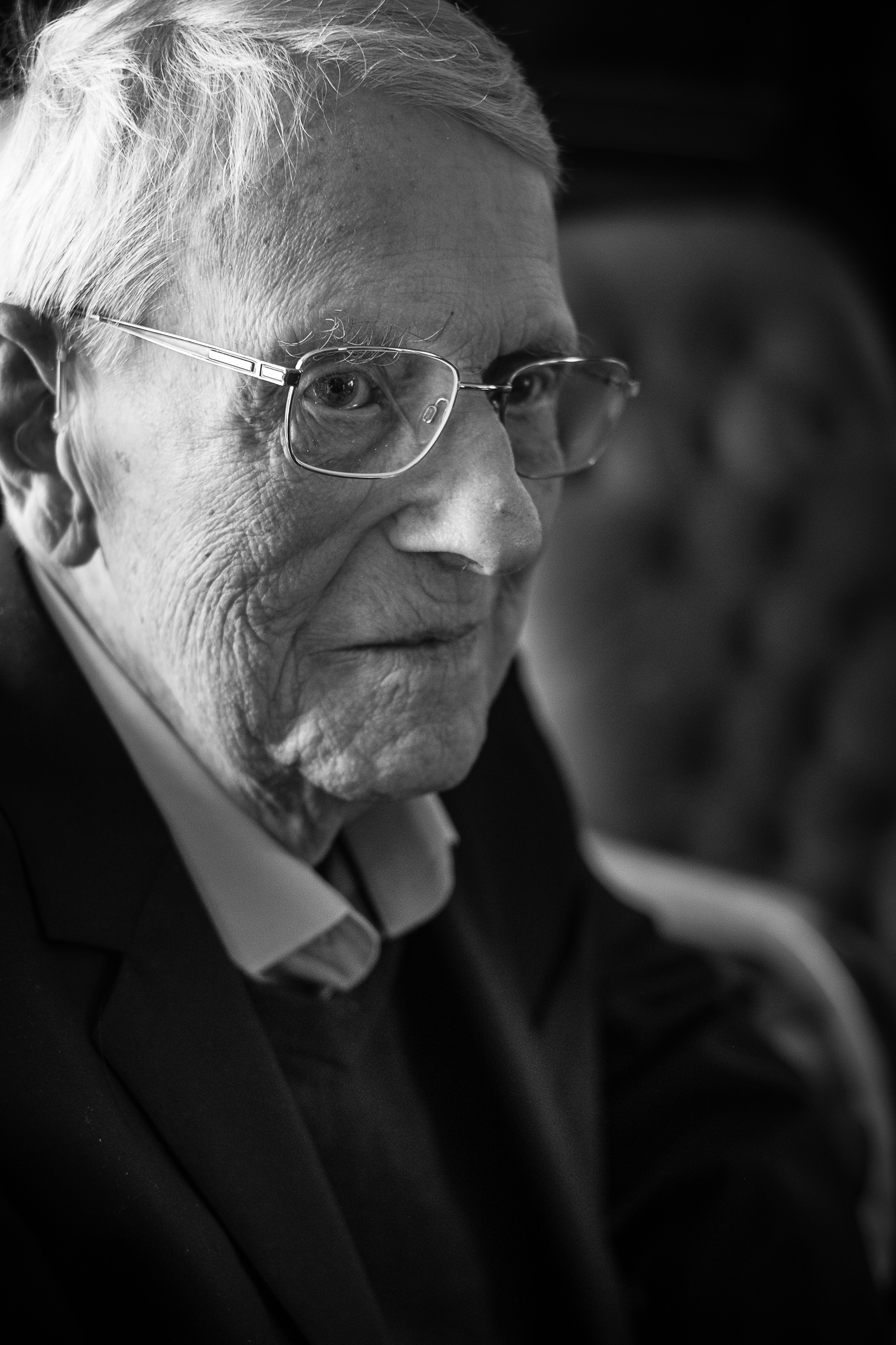
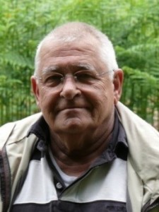
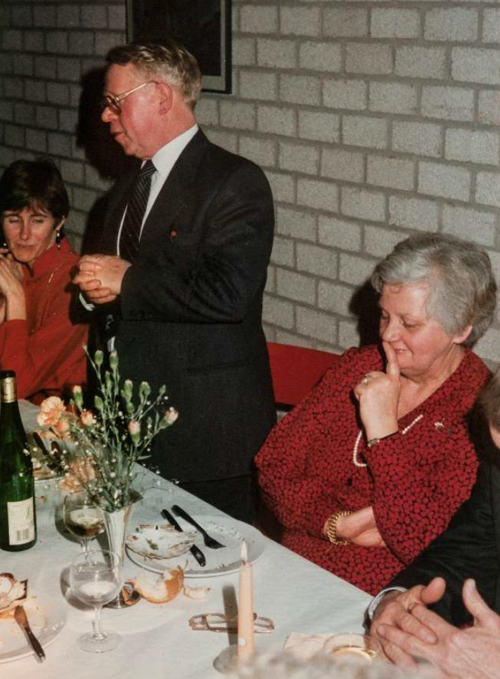
Op 28 januari 2021 is ex-bodemkarteerder Jozef Vandamme van ons heengegaan in het AZ Klina te Brasschaat.
Jef werd geboren op 1 maart 1926 te Geluwe. Na de lagere school in Geluwe en de Grieks-Latijnse humaniora in het college te Menen, studeerde hij landbouwwetenschappen aan de Universiteit Gent. Hoewel hij bijzonder geboeid was door bosbouw, kwam hij terecht in de bodemkunde waar hij als gedreven student opgemerkt werd door Prof. De Leenheer. Nog voor het eindexamen bood deze hem een plaats aan als wetenschappelijk onderzoeker. Jef trouwde met Yolande Van Eeckhoven met wie hij 4 kinderen had. In 1967 sloeg het noodlot toe. Yolanda stierf bij de geboorte van hun jongste kind. In 1968 hertrouwde hij met Mia Rijcken. Jef had 4
kinderen, 14 kleinkinderen en 4 achterkleinkinderen.

Bodemkartering – UGent
Jef vervoegde het grote bodemkarteringsproject van België dat in 1947 als het Comité voor het opmaken van de bodemkaart van België was opgestart onder auspiciën van het IWONL (Instituut tot Aanmoediging van het Wetenschappelijk Onderzoek in Nijverheid en Landbouw). Vanuit het Centrum voor Grondonderzoek, onder leiding van Prof. De Leenheer, doorkruiste Jef België om bodemprofielen
systematisch te beschrijven en te bemonsteren, geassisteerd door zijn ‘veldpreparator’ G. De Vuyst. In het begin gingen ze per fiets, daarna op moto met sidecar en tenslotte met de wagen. Daarmee had Jef enorm veel bodems van België gezien, beschreven en geanalyseerd. Hij was als een encyclopedie die bodems als geen ander kon plaatsen in landschaps-sequenties waarmee de logica van de meest complexe bodemkaarten meteen duidelijk werd. Als eerste in Vlaanderen mat Jef op
systematische wijze grondwaterstanden met behulp van een enorm netwerk van peilbuizen om de gehanteerde vochttrappen bij de bodemkartering te kalibreren. Jef legde de opgedane kennis vast in publicaties, eerst in zijn doctoraal proefschrift dat in 1971, in de toen zogenoemde Rijkslandbouwhogeschool Gent, werd verdedigd met Prof. De Leenheer als promotor:
Vandamme, J., & De Leenheer, L. (1971). Variatie van de textuur van de bovengrond en van de grondwaterstand in de bodems van de provincie Antwerpen. https://lib.ugent.be/catalog/rug01:000236575
Dit werk dient tot vandaag als referentie in het scenario van een uitdrogend Vlaanderen ten gevolge van klimaatsverandering. Andere belangrijke publicaties uit die periode zijn o.m.:
Vandamme, J., De Leenheer, L., 1971. Bodemtextuur van de bouwvoor, landschapsindeling en bodemassociaties in de provincie Antwerpen; https://lib.ugent.be/nl/catalog/rug01:000225892
Een prachtig geïllustreerd werk:
De Leenheer, L. et al.,1966. Natuurspiegel van Oost-Vlaanderen
https://lib.ugent.be/nl/catalog/rug01:000201619

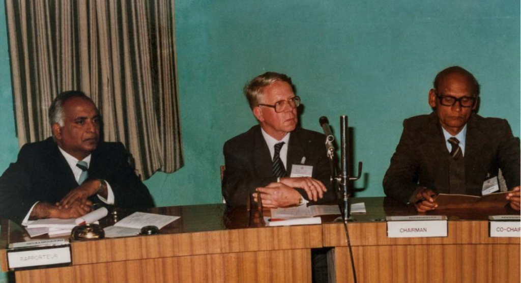
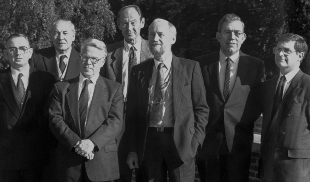
Door deelname aan buitenlandse congressen en studiereizen verdiepte hij zijn wetenschappelijke kennis en deelde ze met anderen. Deze reizen brachten hem o.m. in Oostenrijk, de VSA, het toenmalige Tsjechoslowakije, Hongarije en Roemenië, Spanje, Marokko, India, Hongkong, Japan en Thailand.

Foto: Tuinbouwcongres India, 1989


Bodemgeschiktheid – KU Leuven
Toen het bodemkarteringsproject in begin jaren 1970 ten einde liep, vervoegde Jef het Studiecentrum voor Tuinbouwgronden (IWONL) dat aan de KU Leuven onder leiding van Prof. I. Scheys werd opgericht. Dit was een logisch verlengstuk van zijn loopbaan. De opgedane kennis werd nu ingezet om op systematische wijze de bodemkaart te vertalen naar inherente bodemgeschiktheidsnormen voor groentegewassen. Met de kundige assistentie van Ir. Wim Smets, Paul Janssens en Louis Lettani werden overal in Vlaanderen veldproeven aangelegd om bodemgeschiktheidstabellen te berekenen voor tomaten, stamslabonen, fijne worteltjes, kropsla, schorseneren, bleekselder, pootaardappelen, prei, bloemkolen, spruitkool, aardbeien, asperges en witloof. Jef publiceerde deze schat aan verzamelde kennis in een vademecum van de Bodemgeschiktheid:
Vandamme, J., Deckers, J., Feyen, J., 1994. De bodemgeschiktheid voor groenten Studiecentrum voor Tuinbouwgronden, IWONL gewassen.

Na het overlijden van Prof. I. Scheys verzorgde Jef gedurende enkele jaren het college Regionale Bodemkunde bij de bio-ingenieurs en de archeologen.

Foto: Jef en zijn studenten op het plateau des Tailles, Ardennen anno 1991
Foto: Van links naar rechts: Gastprof. Jozef Mitrikeski (Skopje, Macedonië), Prof. Rudi Dudal, Jef Vandamme, Arenberg Kasteel, 1989

Begin 1990 speelde Jef een belangrijke rol in het COBIS project (IWONL) aan het Instituut voor Land- en Waterbeheer onder leiding van Prof. Jan Feyen, KU Leuven. In dit ambitieuze project werden de onderliggende data bij de bodemkaart van België gedigitaliseerd en in de database Aardewerk opgenomen. Jef controleerde alle cijfers op hun consistentie vooraleer ze door jobstudenten ingegeven werden. Deze database zou een van de hoekstenen vormen van de digitale bodemkaart van Vlaanderen die nu zeer druk geconsulteerd wordt op de website van de Dienst Ondergrond Vlaanderen: https://www.dov.vlaanderen.be/page/bodemkaarten

Foto: Jef in de onderzoeksgroep Instituut voor Land- en Waterbeheer
Foto: Jef op excursie met het labo Landbeheer, Ophoven-Kinrooi, 1991
Foto: Emeritaatsviering, Brasschaat, 1991

Professor Emeritus
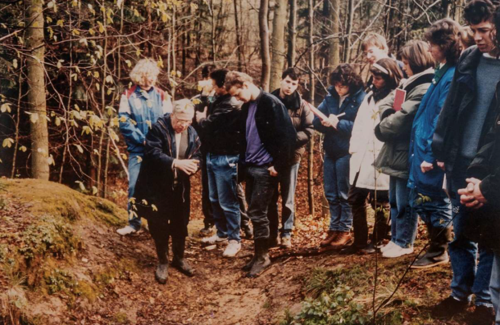
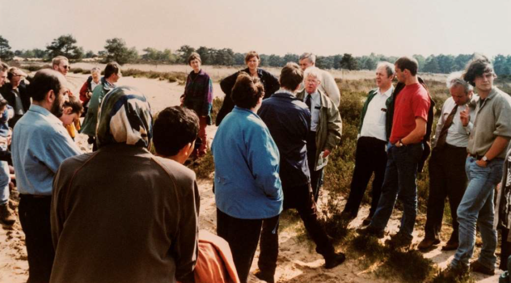
Jef bleef ook na zijn pensioen zeer geëngageerd voor bodem en natuur. Ik herinner me nog levendig hoe hij heel enthousiast de verhalen vertelde bij de bodemmonolieten, een archiefcollectie bij de Bodemkaart van België. Jef kwam graag terug naar Leuven om met onze studenten Bodemkunde in discussie te gaan. Hij was op zijn best tijdens de veldexcursies bij het vak Regionale Bodemkunde tot midden in de jaren 1990. Hij was toen ook gastprofessor aan de Katholieke Hogeschool Brugge-Oostende.
Ook politiek was Jef actief: eerst als gemeenteraadslid (6 jaar), later als schepen van Parken en Plantsoenen in de groene gemeente Brasschaat (12 jaar). Hij heeft zo bijgedragen tot de verfraaiing van lanen en parken. Van het park de Mick maakte hij een klein arboretum. Hij zette mee zijn schouders onder het project van de kinderboerderij Mikerf en het maatwerkbedrijf Aralea. Verder werd hij de stuwende kracht achter het project Brasschaat helpt Roemenië. Hij verzorgde verscheidene transporten
en ging zelf een aantal keren ter plaatse om er een school en een dokterspraktijk te helpen uitbouwen.

Foto: Redactie comité van het boek: Gijsel, J., 1980. Brasschaat van heidegrond tot parkgemeente

Jef was klein van gestalte maar een grote persoonlijkheid, een doorzetter met een enorm rechtvaardigheidsgevoel. Hij was veelzijdig geïnteresseerd in talen, kunst, muziek en geschiedenis. Hij zal in ons hart voortleven als zeer gemoedelijk, beminnelijk en bescheiden. Op een ereplaats in het Geo- Instituut te Heverlee hangen de bodemmonolieten van België als stille getuigen van de vele boeiende verhalen die Jef ons toevertrouwde. Zijn uitgebreide kennis is recentelijk toegankelijk gemaakt via de bodemmonolietenwebsite: https://ees.kuleuven.be/soil-monoliths/
Graag betuigen we onze innige deelname aan de familie en nabije kennissen.
Met speciale dank aan Ria Vandamme en Georges Hofman (UGent) voor de bezorgde informatie.

Seppe Deckers
Hoogleraar Emeritus met opdracht
Departement Aard en Omgevingswetenschappen, KU Leuven

In Memoriam Prof. Jules D’Hoore (1917-2017)

Jules D’Hoore was born in Sluis (the Netherlands) on 7th May 1917, while his family was on exile as Belgian refugees during WWI.  After the war his family returned to Bruges where he followed the Greek-Latin option at St. Lodewijkscollege. During the WWII Jules’s university studies were disturbed by the war mobilization and he was war prisoner for a short period. Eventually he obtained his diploma of Engineering in Chemistry and Agricultural Industries from the State Higher Agronomic Institute in Ghent 1943. He stayed on as assistant at the Faculty of Sciences of the State University of Ghent, in the Laboratory of Analytical Chemistry (Prof. J. Gillis).

In 1946, Jules undertook his first mission to Congo as assistant researcher in the Department of Agrology, INEAC, Yangambi. While serving as visiting Researcher of Wisconsin, USA in 1949 he made visits to soil laboratories of the Universities of Ames, Cornell, and Pennsylvania  State and to the US Soil Conservation Service, Washington, DC. In 1951 Jules participated to an OECE mission (3 months) in western Africa in company of L.T. Alexander (USA), R. Maignien and G. Aubert (France), and C. Bloomfield (UK): field study of laterisation phenomena.

In 1950 Jules D’Hoore started his doctoral project under supervision of L. De Leenheer at the then State Higher Agronomic Institute in Ghent (which later became the Faculty of Agricultural Sciences of the University of Ghent). On 10th September 1953 he defended summa cum laude his thesis with title ‘The Accumulation of free Sesquioxides in Tropical Soils’. He was the first to obtain his PhD at this Institute/Faculty, not his last pioneer achievement. With this thesis he became a world authority on the processes which lead to laterite soils (present-day Plinthosols).

In 1953 he was detached to the Commission for Technical Cooperation in Africa (CCTA) as Director of the Service Pédologique Africain / Interafrican Pedological Service (SPI). In 1954 Jules was involved in the preparation of the “II° Conférence Interafricaine des Sols” (2nd Inter-African Soil Conference) and the International Soil Congress of Leopoldville, Congo. In this period he started assembling the soil map of Africa at 1/5,000,000 scale. For that purpose he made several visits to the major soil centers of Africa and Madagascar along with field work during numerous soil correlation meetings with regional soil scientists active in Africa.

During his fourth mission to Congo in 1956 he designed a first approximation of the Soil Resources Map of Africa and of its provisional legend. This map was verified during numerous regional workshops all over Africa. The third approximation of the Soil Resources Map of African was presented in 1960 during the 7th International Soil Congress at Madison, USA. At that time, the baseline documentation of that map, stored in Yangambi, becomes inaccessible, because of the evacuation of this research center. Jules had no other option than reconstituting this documentation by personal mailing to correspondents. He was temporary hosted by the “Service Pédologique Interafricain” (Inter African Soil Service) in Ghent, thanks to the hospitality of Professor De Leenheer and Professor Tavernier. In 1962 he is assigned as member of the “Advisory Committee Project World Soil Map”, FAO-Unesco.

In 1962 Jules joins the Centre for Tropical Soil Studies at Katholieke Universiteit Leuven. He drafts the Fifth Approximation of the Soil Resources Map of Africa which is eventually published in 1963 in French and in English along with its legend and an elaborate explanatory text.

In 1970 Jules makes a study visit to the Goddard Space Flight Center, Maryland, USA and studies remote sensing techniques and their usability for soil observation and broad scale soil  mapping. As of then he is prominently present in international fora on remote sensing (ESRO) as delegate from Belgium, among many others the new department of Remote Sensing of the Joint Research Centre, EURATOM, Ispra, Italy. He also was the inspirator of a state funded programme on remote sensing studies in Belgium. In 1976 he becomes the permanent Belgian member at the Remote Sensing Advisory Group at ESA (European Space Agency), charged by the Science Policy Office, Brussels.

Also in that year he is elected President  of the Soil Science Society of Belgium. As of 1977 Jules is  member of the “Klasse voor Natuur- en Geneeskundige Wetenschappen van de Koninklijke  Academie voor Overzeese Wetenschappen” (Class for Nature and Medical  Sciences of the Royal Academy of Overseas Sciences). He also gets actively involved in the first versions of Belgium-supported Inter-University Development Cooperation with missions to Zambia, Malaysia, Thailand and Congo. In 1983 Jules is  Entitled Member of the Class for Nature and Medical Sciences, Royal  Academy of Overseas Sciences. During his professional career, Jules D’Hoore was honored several times with awards such as the price “Wetteren”, Royal Academy of Sciences, Belgium (together with J. Fripiat), the “Medal Order of the Lion” and “Great Officer in the Leopold Order”.

With his lectures edging at the frontline of scientific development, Jules D’Hoore was an excellent professor, giving his students a world view on soil genesis and soil geography, and a strong feel for interdisciplinarity, as he had worked with agronomists, geologists, ecologists and others during his career. With his Soil Resources Map of Africa he made school internationally and this valuable document still remains till today an important reference milestone from where new tropical natural resources work is starting. Jules D’Hoore’s soil map of Africa was recently the center-piece of the ‘Africa in Profile exhibition’ which was organized at KU Leuven to mark the International year of the Soil in 2016. For the occasion, Jules kindly allowed recording an elaborate interview in which he reflects on his Soil Resources Map of Africa.

Jules D’Hoore from Sarah Garre on Vimeo.

Jules D’Hoore had a somewhat rigid appearance, but in fact he was a sensitive person, with discrete empathy for those in need. He was famous for his erudition, fluency in languages and his interest in art, culture and history, which he liked to share. Jules had a sarcastic sense of humor and a capacity for making verbal caricatures. His speech at the day of celebrating the end of his career will be remembered for two rather ‘Julian’ expressions: he compared the soil to a ‘palimpsest’ – a reused manuscript bearing traces of older writings, and he likened his career as a ‘time of great delight’. During his long retirement period, he kept delight in remembering his achievements and sharing it with visitors.

Jules D’Hoore passed away in his home on 19/09/2017,  a few months after he celebrated his 100th anniversary with family and friends. He was a great man, a polymath whose stories will continue living on among the large community who had the chance of knowing him.

We end this in Memoriam with two quotes from Jules which we found in his Memoires (Family Archive, 2004):

“…during our long travel through West-Africa for studying laterites in the Sahel, we often slept the night on a roof terrace. Safe of the odd cycads it was dead-silent, the stars hanging high in the sky like balls on a Christmas tree in the firmament. Sleeping in, I was thinking of the immemorial Chaldese astrologists, or better the proto-theologists, who could read God’s will from the run of the stars. They stood round me in a big group and I could recognize Copernicus, Galilei and Kepler. In that that excellent company I fell asleep till the morning chill woke us up to see the first stripe of yet another sunny day… “

“During my career I was able to travel a lot by sea, by land and though the sky… I could reflect and dream away above mountain chains, tropical rain forest, steppes and deserts, icy plains of Greenland, a snow-covered Canada, great water falls … Victoria, Niagara… safe dreaming is never to be taken for granted, also not when watching mother earth from the window of an air plane…”.

By Hubert Gulinck and Seppe Deckers

Prof. Jules D’Hoore deceased

It is with great regret that I have to communicate the sad news  that Professor Jules D’Hoore passed away on 10 September 2017. As you may remember he celebrated his 100th anniversary on May 7th 2017-  http://www.bbv-sbss.be/?cat=261

Professor D’hoore was a great soil scientist who will always be remembered as the author of the first comprehensive soil map of Africa – http://aow.kuleuven.be/outreach/

An extended In Memoriam will follow soon.

Seppe Deckers
President, Soil Science Society of Belgium

In memoriam Prof. Jan Frans De Coninck 1926-2017

Photo Frans De ConinckDr. ir. Jan Frans De Coninck, Honorary Professor of Soil Science at the Faculty of Sciences of the Ghent University in Belgium died on June 10, 2017 at the age of 91. “Frans”, as he was known to friends and associates, was a distinguished and inspirational soil scientist, well respected by his peers and especially by the many generations of MSc and PhD students, coming from all over the world, he taught and supervised in the 1970s and 1980s at the International Training Centre for Post-graduate Soil Scientists at Ghent University in Belgium. His professional experience included: soil survey, soil chemistry, soil mineralogy, soil micromorphology and soil genesis. He established an international reputation for his research on the genesis and properties of Spodosols/Podzols.

Frans De Coninck was born on April 24,1926 in Diegem, Belgium and grew up on a farm in the neighborhood of Brussels as the youngest of a family with 7 children. He had always the idea to become a “scientific” farmer. But at the Catholic University of Leuven he was so attracted by chemistry and soil science that the scientific activities became more important than the real farmer activities. He prepared a thesis in soil science and was awarded the degree of Agricultural Chemistry Engineer in 1948.

After his military service and a short time as a Chemistry Engineer in the private sector, he joined in 1951 the Belgian Centre for Soil Survey, and this was the beginning of a brilliant career in soil science. He was chief cartographer and soil correlator in the Antwerp Campine.

When soil survey became too much a routine for him, he started in 1959 to study soils, mostly sandy and glauconiferous soils of his survey area, under the microscope in collaboration with Dr. Jacques Laruelle from Ghent University. Because the microscopic research left many questions on composition and mineralogy of these soils unanswered, Prof. Dr. René Tavernier, Director of the Soil Survey Centre, proposed him in 1963 to carry out a thorough fundamental study on the mineralogy of the soils of the Antwerp Campine, as a part-time researcher at the Laboratory of Mineral Chemistry at the Catholic University of Leuven. In this laboratory he joined a world-famous research team under the coordination of Prof. Dr. José Fripiat and he got acquainted with a series of new analytical techniques in soil chemistry and mineralogy. He gained his PhD in Agronomy in 1967 from the Catholic University of Leuven for a thesis entitled Physico-chemical Aspects of Pedogenesis in the Antwerp Campine and was appointed Head of the Laboratory at the Department of Regional Pedology of the same university.

In 1968, Frans De Coninck joined the Ghent University and became Head of the Laboratory for Soil Analyses at the Department of Physical Geography and Regional Pedology (Head: Prof. Dr. René Tavernier); a position he held until his retirement. His research interests included the investigation of soil forming processes and mineralogy of soils from all over the world, but preferentially Podzols. His investigations on spodic materials showed the usefulness of soil micromorphological information in studies of Spodosol genesis. He did groundbreaking research, especially in micromorphology of Podzols in close collaboration with French soil scientists, i.a. Dominique Righi, and contributed in this way to the improvement of the classification of Spodosols in Soil Taxonomy. His research findings on podsolization were compiled in a book “Genesis of Podzols” with which he obtained in 1981 the Aggregate for Higher Education and became in 1982 the Laureate of the Royal Academies for Science and the Arts of Belgium.

Dr. De Coninck was active in several professional societies. He was Vice-President of Commission VII (Soil Mineralogy) of the International Society of Soil Science and European Coordinator of the ICOMOD-Commission (Spodosols) of the Soil Conservation Service of the United States Department of Agriculture (USDA)..

In 1989, Dr. De Coninck was appointed Associate Professor at the Laboratory for Regional Pedology and Land Evaluation, Ghent University. After his retirement in 1991, Prof. Dr. De Coninck was until 1996 still active as the chairman of the Soil Experts Group of an International co-operative programme on assessment and monitoring of air pollution effects on forests in the ECE region, sponsored by UNEP-UNECE.

Em. Prof. Dr. Eric Van Ranst
Ghent University, Belgium

In Memoriam: Marcel Jamagne 1931-2015

Marcel Jamagne
Marcel Jamagne

Marcel Jamagne est décédé à Orléans le 30 septembre 2015. Il était né à Bruxelles le 17 novembre 1931.

De nationalité belge, il prend la nationalité française en 1978. Après des études d’ingénieur agronome, spécialisation eaux et forêts à La Faculté des Sciences agronomiques de Gembloux, et son service militaire en qualité d’officier de réserve à l’armée de l’air, il commence en 1957 une carrière de pédologue cartographe à la Division d’agrologie de l’INEAC, l’Institut national pour l’étude agronomique du Congo (aujourd’hui République démocratique du Congo).

Ce groupe Prospection et Cartographie de la Division d’agrologie est dirigé par Carl Sys qui deviendra par la suite professeur de pédologie tropicale à l’Université de Gand. Durant cette période congolaise, Marcel Jamagne effectue deux missions pédologiques importantes, celle de la Tshuapa dans la cuvette du fleuve Congo et celle du Maniema en limite du Sud Kivu. Il participe également à la rédaction de l’ouvrage « La cartographie des sols au Congo, ses principes et ses méthodes » (Sys, 1961) qui est le premier manuel publié en français sur les méthodes de cartographie des sols.
De retour en Belgique en août 1960 suite aux événements dramatiques se déroulant au Congo devenu indépendant, il intègre le Service de la Carte des sols de Belgique (Directeur : René Tavernier) et participe à la prospection pédologique en Ardennes en collaboration avec Joseph Deckers (le père de Seppe).
A la même période, en France, Jean Hébert (INRA) directeur de la Station agronomique de Laon crée le Service de la Carte des sols du département de l’Aisne. Ce jeune service a pour mission d’établir une carte des sols à moyenne échelle (1/25 000) à partir de levés de terrain à grande échelle (1/5000) sur tout le département. Pour développer ce service, Jean Hébert connaissant le travail identique réalisé pour la carte des sols de Belgique s’adresse à René Tavernier pour obtenir sa collaboration par l’intermédiaire de l’un de ses pédologues expérimentés. Marcel Jamagne devient ainsi en 1961 le Directeur du Service de la Carte des Sols de l’Aisne, direction qu’il quitte en 1969.
Durant ces années “Jamagne”, le Service connaît un développement exceptionnel grâce à ses compétences, son efficacité et son rayonnement. Le rayonnement du Service de l’Aisne est non seulement national mais aussi européen. Marcel Jamagne soutient et encourage aussi ses adjoints à l’étude des sols (recherches en pédogenèse) ainsi qu’à la formation continue. Lui-même suit la licence de cartographie des sols (1966) dispensée par l’Université de Gand où il présente un mémoire sur l’aspect micromorphologique des sols sur limon lœssique.
A partir de ses expériences de la cartographie des sols en Belgique, au Congo puis maintenant en France, il publie un ouvrage qui fera date en pédologie de terrain et deviendra un référentiel pour de nombreux pédologues ; il s’agit de « Bases et techniques d’une cartographie des sols » (INRA, 1967). Parallèlement, il entreprend une recherche fondamentale sur l’évolution des sols lessivés du Bassin de Paris, recherche qui aboutit en 1973 à la soutenance d’une thèse de doctorat à la Faculté Universitaire des Sciences agronomiques de Gembloux sous le titre « Contribution à l’étude pédogénétique des formations lœssiques du Nord de la France ».
Pendant cette période s’élabore sous la direction de Jean Boulaine et de René Bétremieux la classification française des sols qui voit le jour en 1967 et à laquelle participe activement Marcel Jamagne. Toujours durant cette période (1967-1968), Gustave Drouineau, alors inspecteur général de l’INRA plaide la création du Service d’Etude des Sols et de la Carte Pédologique de France (SESCPF) et c’est à Marcel Jamagne qu’est confiée en 1969 la direction et le développement de ce nouveau Service. Ce Service s’installe d’abord dans le centre INRA à Versailles et les travaux sont presque exclusivement orientés vers la cartographie des sols pour une présentation à 1/100 000 selon le découpage de l’IGN et par rapport à un schéma de classement taxonomique. En 1982, le Service s’installe dans des nouveaux bâtiments à Orléans. Petit à petit ; la cartographie des Sols évolue vers la représentation de séquences paysagiques basées sur la notion de « pédopaysage ».
La dynamique du SESCPF insufflée par Marcel Jamagne va conduire à la réalisation de nombreuses actions de recherches se rapportant à la compréhension de la distribution, du comportement et du fonctionnement des sols dans le milieu naturel. Avec l’installation à Orléans, le Service s’enrichit d’un laboratoire de physique et de minéralogie des sols et d’une unité d’informatique.
En 1990, le programme IGCS (Inventaire, Gestion et Conservation des sols) élaborant pour les grandes régions administratives une base de données à 1/250 000 et pour des secteurs de référence des documents à 1/10 000 prend la suite du programme initial des cartes à 1/100 000.
Conjointement au développement et à la direction de tous ces programmes traitant de l’espace national, Marcel Jamagne participe à différents programmes européens et internationaux (FAO, UNESCO, CCE puis UE) tout particulièrement par le canal du Centre Commun de Recherches (JRC : Joint Research Center) puis du Bureau Européen des Sols à Ispra. Grâce à la compétence reconnue des ingénieurs du Service, celui-ci se voit confier progressivement la coordination scientifique de plusieurs programmes importants dont celui de la Base de Données Géographiques des Sols de l’Europe (Soil Geographical Data Base for Eurasia and the Méditerranean) sans compter la participation à d’autres programmes en Amérique latine et en Asie. Marcel Jamagne peut être considéré comme le père de la cartographie des sols en France et un des pères de celle en Europe.
Il quitte officiellement la direction du SESCPF en 1997 quand celui-ci est scindé en deux unités : Infosol et Science du Sol. Il est alors nommé par l’INRA Directeur de recherche émérite et chargé de mission. Mais a-t-il un jour vraiment pris sa retraite ? Chargé de mission, il s’implique surtout dans le programme de la Base de Données Géographiques des Sols de l’Europe. Il continue à intervenir (1994-2004) dans le DEA national de pédologie et particulièrement lors des camps de terrain. Il rédige également un remarquable ouvrage de synthèse sur les sols de France avec pour titre « Grands paysages pédologiques de France ». (Quae, 2011). Quelques semaines avant son décès, il travaillait encore à l’actualisation d’une carte des sols à 1/100 000.
Marcel Jamagne était membre de l’Académie d’Agriculture de France et membre d’honneur de l’Union Internationale de Science du Sol, chevalier de la Légion d’honneur et officier du Mérite agricole (France). Il a été président de l’Association française pour l’Etude du sol (1996-1999) et vice-président de l’IUSS (1994-1998)
En dehors du scientifique exceptionnel et du chef remarquable, Marcel Jamagne était un homme extrêmement chaleureux, très humain, au regard pétillant, au sourire malin, ayant toujours un mot pour redonner de l’entrain. S’il avait une ambition personnelle, celle de rendre toujours son travail le plus achevé possible, il était également soucieux de la promotion de ses collaborateurs, du plus petit technicien jusqu’à l’ingénieur.
Marcel Jamagne était un travailleur exceptionnel et infatigable. Combien de week-ends passés à reprendre des textes de publication ou de rapports, combien de soirées de travail dans son bureau personnel ou sur la table du salon jusqu’à ce que la fatigue l’abatte et l’oblige à prendre un court repos. Toute cette somme de travail, tous ces écrits n’ont pu être réalisés que grâce à l’amour de Christiane, son épouse, qui a accepté un sacrifice peu commun que d’autres auraient refusé, quand ce n’étaient pas d’autres soirées entre amis pédologues où nous refaisions le monde de la pédologie.
Aucun de ceux qui l’ont connu, Aucun de ceux qui l’ont approché de près ou de loin, personne ne l’oubliera. Marcel Jamagne lègue à la Science du sol un héritage d’une richesse et d’une importance remarquables qui marquera pour longtemps notre discipline.

Clément MATHIEU

IN MEMORIAM: Mrs. Sofie Bruneel

Mrs. Sofie Bruneel
Mrs. Sofie Bruneel

On July 25th 2013, our colleague Sofie Bruneel sadly passed away due to the consequences of an illness. For over a decade, Sofie was the right hand of the Secretary-General. She voluntaily arranged so many things for our society, all with an unmatched dedication and efficiency.

To name a few: Sofie organized all practical issues of thematic days and excursions, managed budgets and records, followed-up with the IUSS and the Royal Academy, handled memberships and actively maintained communication with our members. Her commitment did not go unnoticed: with her help, memberships were steadily increasing.

We are extremely grateful to Sofie for all the work she put in. But even more than that, we will miss her kind personality and positive approach. She always had a smile and friendly word for everyone, was interested in our personal endeavors and no matter what it was one asked her advice for, she would do whatever she could to help out.

When we discussed the future of the society only weeks before she died, she was so enthousiastic about the success of the excursion and the increasing number of young soil scientists that had joined.

Karen Vancampenhout, Secretary-General Soil Science Society of Belgium